Friday, May 7, 2021

Riding on top of a jeepney

In 2019, I visited an unique rice terrace on high mountain called Batad, in central Luzon, northern Philippines. It is a world Unesco Heritage.

Going to Batad from central Manila will need an approximately 12 hours. I took an overnight bus that left at 10pm and reached Banaue, a small rice terrace town at around 5am. 

The tourism office did not give a good impression about their welcoming service, as the officers refused to share their public transportation information. Instead, travelers were encouraged to take the private tricycle or car available. Then I hired a tricycle to bring me to Batad, an hour away after a morning breakfast. 

Batad is a mountainous village, where the houses are built on the slopes, surrounded by layers of mountainous rice terraces, built over 2000 years of legacy. Upon reaching Batad, I started my trek down the hilly slope to my homestay guesthouse right at the bottom of the valley. The stairs are winding and the route is through village houses and paddy fields. It is a mesmerizing view, seeing the houses and paddy fields below as I trekked down. It seems near yet so far, as I took an hour to reach the bottom from the top, despite a signboard claiming 10 mins. 

Beautiful mist greeted me in the morning

Stairs connecting the village

View along the trek down to guesthouse


Walkway to guesthouse right at the bottom of the valley

Imagine, sitting at the porch of the guesthouse, viewing the paddy field right in front with a hilly backdrop. A true heaven in nature. 

View from guesthouse

Tranquil village life

Later on the day, I explored Tappiya waterfalls by trekking up and down to the falls. Sitting half way on the journey in a porch, overlooking the majestic rice terraces on the slopes just took my breath away... 

Tappiya Falls

View from the top on the way to the waterfalls

The next day, the exploration continued with more trekking up and down the surrounding rice terraces. Sitting at a simple hut, chilling on a bottle of beer with the awesome mountainous rice terrace view was a great blessing. Human ingenuity was established even 2000 years ago with the ability to carve the terraces for paddy without any modern technology back then, yet still lasting until now.

Stairway to heaven

View from the top

Exploring the terraces

One of the relaxing activities is to have Swedish massage back in the guesthouse, besides just doing nothing but enjoying the scenery. Surprisingly, massage in Philippines is cheaper than in Thailand, especially with the increasing value of Thai currency. One hour of painful Swedish massage was less than USD10, compared to Malaysian currency as of 2019.

Can you see the guesthouse?

Traditional village hut with stairs

View from below the hut

On the last day, I sadly waved goodbye to this peaceful village. Trekking up the slopes took another 1 hour before I managed to get a public jeepney (their local bus) back to Batad. The best experience was to ride on top of the jeepney, with 360 degree view of mountains and valleys along the winding mountainous road. The same happened on the jeepney ride from Batad to Sagada, another unique region in central Luzon. This rooftop jeepney ride is only available in this region. I was truly blessed... 

Rooftop ride from Batad to Banaue

Another rooftop ride from Banaue to Sagada


Wednesday, April 14, 2021

The Pride of Sri Lanka

When we set our foot on the land of Sri Lanka, the first impression was, it was a hot country. There were 2 places among the few highlights we visited that impressed me the most, the iconic Sigiriya and Horton Plains National Park. Another less impressive place was Nuwara Eliya. 

Coconut as the best thirst quencher

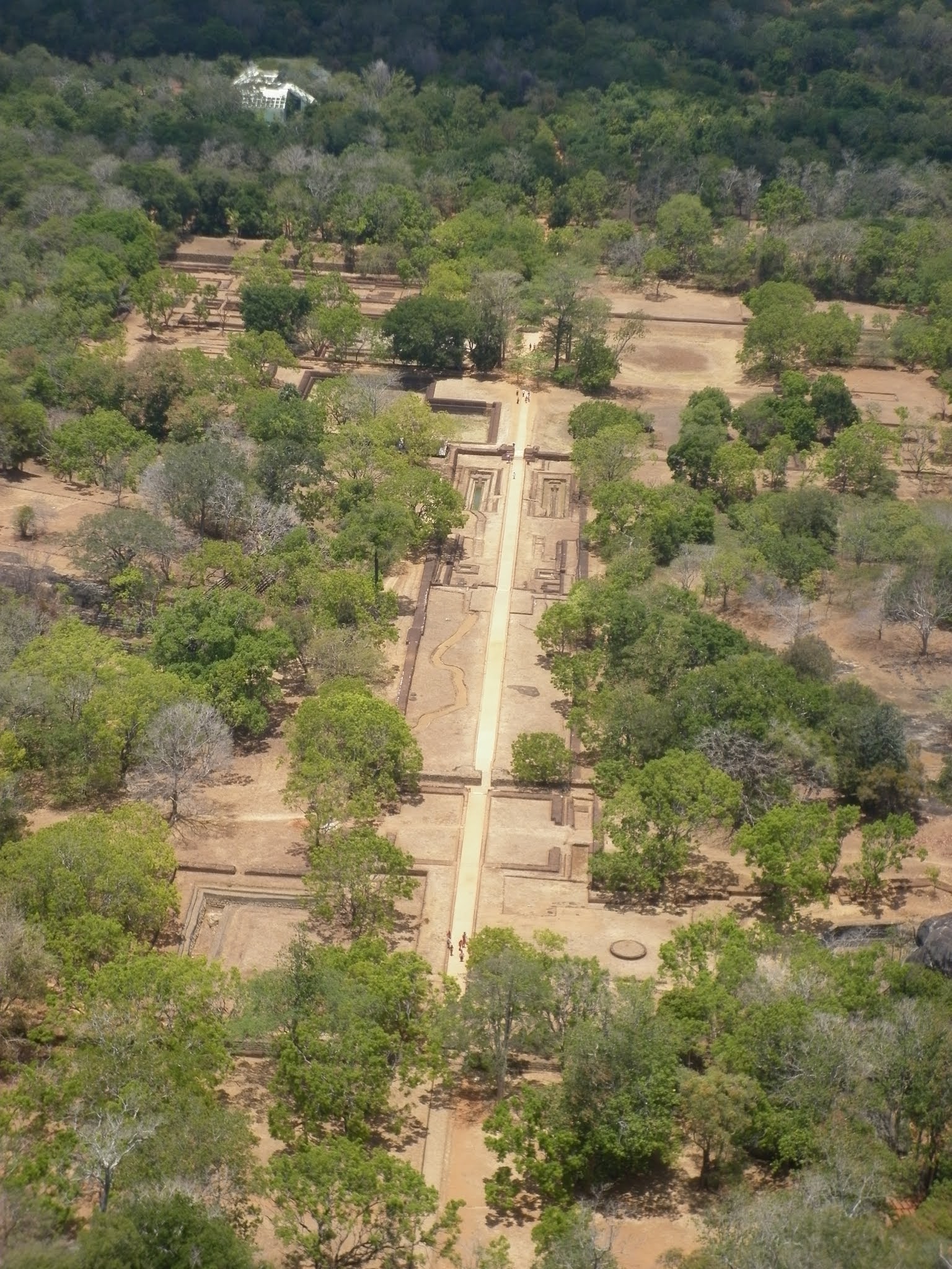
Sigiriya is an ancient 200m high rock fortress which served as a palace and monastery. It is also called as Lion's Rock and is a UNESCO World Heritage. The palace was surrounded by moat, just like the ancient Japanese palace. We had to climb steps to the top. It was a hot bright sunny day. Standing on top the giant rock was like standing on top of a mountain, high up on the group with bird eye view of the surroundings. I could not imagine how those people carried themselves and things high up without stairs, unlike right now which are built for tourists. 

Entrance to the "Eight Wonder of the World" as claimed by locals

Moat surrounding the ancient fortress

Lion's feet with stairs on the rock wall

View from the top


Nuwara Eliya is a hill country retreat famous for its tea plantation. Located midway between a lowland and a highland, the weather could be cooling in the morning. Indeed, it is claimed as the coldest place in Sri Lanka. However, I would still prefer Malaysia's Cameron Highlands as landscape is more pictureque. However, it is relaxing to stay a night and walk around the town.


Ancient tea processor


Tea plantation

Township of Nuwara Eliya

Horton Plains National Park is a flat grassy plateau covering a stretch of 9,5km loop walk at an elevation of 2000-2300m. The journey from Nuwira Eliya towards Horton Plains was an unforgettable scenery, with a feeling of being in west countryside with cows roaming around. On the way to the national park on an isolated misty road, we encountered a huge antelope resting on a roadside. That was the perfect opportunity for an unique picture with the animal as the background. 


Isn't it a nostalgic feeling with the ancient looking bus?

Cows blocking the road

Blessed to see a sambar deer

Endless grassland
                                                                                   
I was truly mesmerised with the quiet, tranquil grassland. Along the loop walk, we visited a small waterfall called Baker's Falls. The key highlight of the national park was an awesome cliff called The End's World. Imagine snapping a picture with a deep drop of 880m into the valley down below behind you. 

Start of trek

Tranquility

Baker's Falls

The journey continues

World's End at 880m high

I could never imagine Sri Lanka has such a gorgeous grassland high on the land mimicking an NZ grassland, except with a different weather and animals..

Monday, March 22, 2021

Adventure in Hualien City Taiwan

When people visit Hualien in Taiwan, the first must visit place is Taroko National Park. Hualien is a city in the east of Taiwan, the name reminds me of the one of the largest Buddhist Associations in the world, Tzu Chi, which is founded here. 

The city itself is not very big. The best way to explore the city is by cycling. My cycling tour started from the hostel in downtown toward a morning market, where I was surprised to get a good quality winter shirt at a very affordable price. Then the cycling adventure continued toward the outskirts where I could see private vegetable farms sprouting in front and backyard of houses with a nice hilly backdrop. 


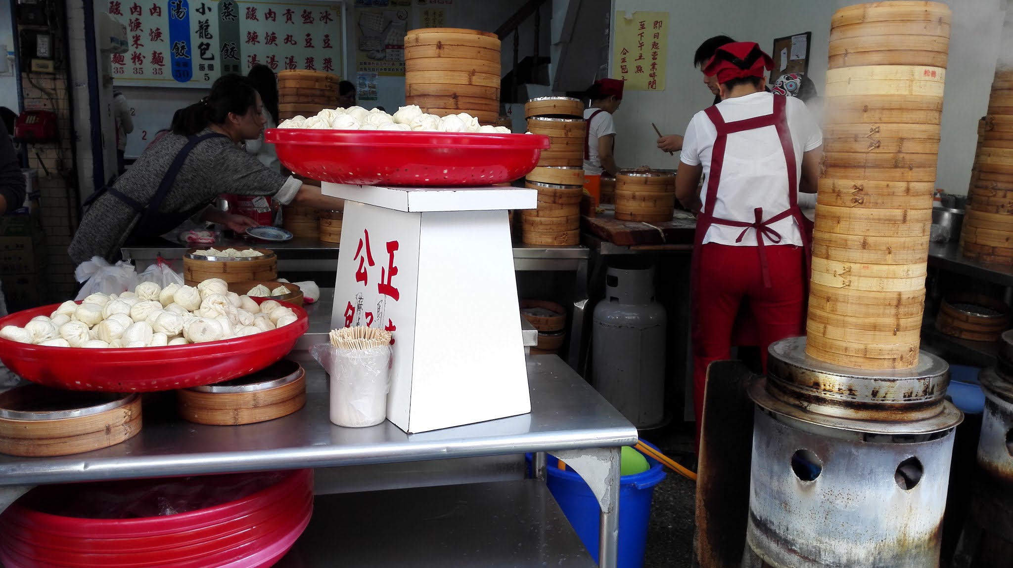
Next, a temple and another local market to look for the famous tiny Chinese steamed bun (pau) before going for some mini sight seeing shopping around the city. 


In the evening, cycling at Nanbin Park along the sea coast with the breezing wind was indeed a relaxing pass time. The day ended with a visit to the famous Dongdamen Night Market for food hunting.


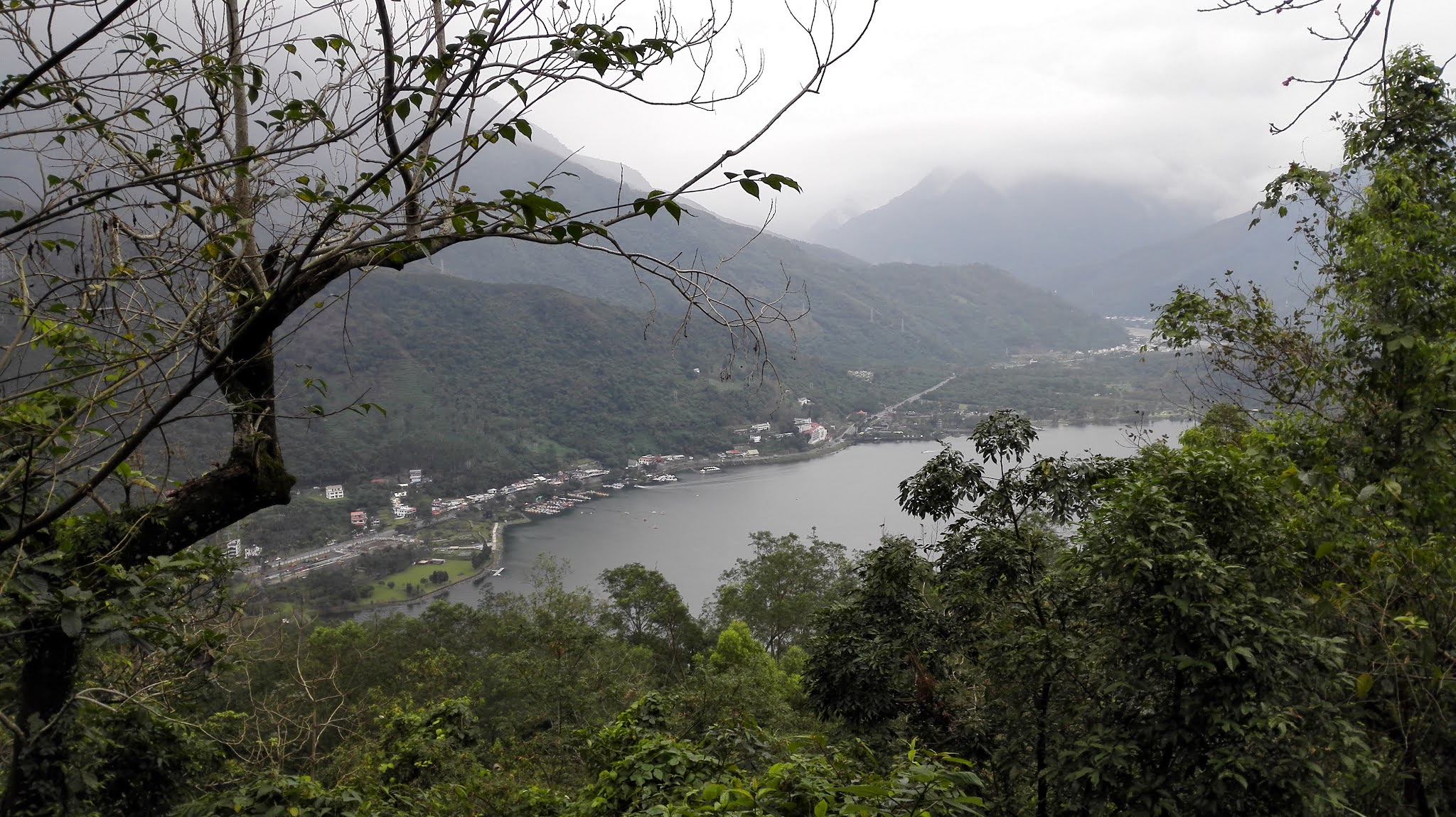
Another attraction in the city is Liyu Lake, at the foot of Liyu Mountain, not far from the city. One can walk around the lake which takes about 30 minutes. After walking, I decided to hike Liyu Mountain, just besides the lake. There are 3 main trails to go up and down the mountain. I hiked up from one trail and down through the other. It took about 1 hour to reach the peak. It was quite scary to hike up alone, as there are many signs along the trail with snake pictures. Besides, during my hike, I was alone, upon reaching the top, I had to walk on a tarred road toward the other end before I entered another trail to the peak. I was lost on the direction and nervous as it was shady with loud dog barks from a house near the mountain top. Luckily, there was a man riding a motorbike and I waved for direction. The peak was a plank with some view. I hurriedly walked down through the other trail as there was no one and the snake pictures only added to my suspense. I would not recommend to hike alone in Liyu Mountain.


Overall, Hualian itself is a nice tranquil city with friendly people. Many people visit Hualien because of the iconic Taroko National Park. That would be in another story... 

Saturday, February 13, 2021

Mesmerising Mt Fuji

Mt Fuji (3776m) is only open for hikers in July and August yearly. There are 4 main trails to hike Mt Fuji. The most popular and easiest trail is Yoshida Trail. There is a bus from the base town of Mt Fuji, Kawaguchiko, to Fuji Subaru Line 5th Station in about an hour journey. The suggested hiking time is 5-7 hours but I took a total of 9 hours! 

The beginning of the hike with gradual slopes

The trail towards 7th station

The hiking journey started in the afternoon around 1pm on the 1st day. We just need to register for free and paid a donation fee at the entrance. After 3 hours of slow hike on a gradual wide trail, I reached the 7th Station, where I had pre booked an accommodation for the night. Even though it was supposed to be for the night, by 11pm, most guests started to continue the hike up in order to catch the early morning sunrise the next day. The accommodation is more for a rest rather than for a sleep, It is a basic accommodation, with only sleeping bag lying on the floor side by side. As the evening approached, the weather turned into a chilling freezing night.

Accommodation at 7th Station

At 11pm, I packed my luggage to continue the hiking journey with headlamp in pitch dark. However, the crowd and mountain huts along the way illuminated the scene with sounds and lights. It was a steep long hike from 7th to 8th station, with added challenge from the thin air in high altitude that made the trek breathless and sleepy. I dozed off momentarily at one of the mountain hut passages along the trail not long after starting the hike. The trail becomes narrower and steeper after 8th Station.

Can you see the sea cloud?

Finally, after 6 hours of dark endless slow hike, I saw the first ray of bright orange sunrise amid the clouds at 5am. It was near the peak of Mt Fuji and the sense of awe was beyond words. Finally, I reached the peak of Mt Fuji, the highest mountain in Japan with clouds below.

Finally the sun ray appeared

Light from heaven 

After about 2 hours of rest and pictures, it was time to descend, as the sun rose upon the sky. There are 2 separate trails for ascend and descend in Yoshida Trail. The trek downhill is rocky on a gradient slope. It is indeed a volcanic mountain. Another mountain checked! 

Crowded mountain top with vending machine

Looks like another outskirt town on the top

Seats to rest

Separate rocky trail to go down 

Tips to hike Mt Fuji (Yoshida Trail):
  • Bring winter clothes, gloves and jacket as it can be freezing up there
  • Bring a headlamp for night trek
  • A walking stick could help for support
  • Pre book accommodation early as it is a peak season
  • Try to book accommodation at 8th Station onwards as it is nearer to the peak
  • Bring small change for Bio/Toilet Break. The higher the elevation, the more to pay for Bio Break (from 1000 yen to 3000 yen)
  • The hike can be done overnight without staying at the mountain huts. Many locals start hiking around 8pm from 5th Station and reach by 5am to view the sunrise before descending to reach the base by 1pm the next day.
  • The hike can be done solo or on own groups without joining a trekking tour